


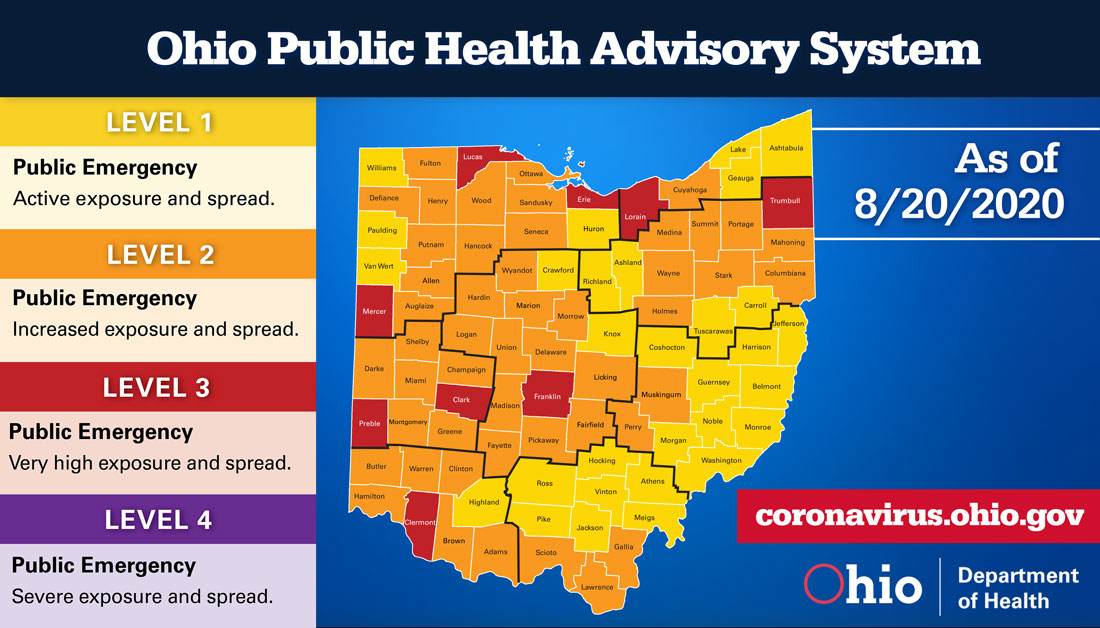
 On August 20, Governor Mike DeWine released the week’s Ohio Public Health Advisory System map. New health data compiled by the Ohio Department of Health indicates that nine counties currently have a very high risk of COVID-19 exposure and spread.
“Ohio continues to see a shift in virus spread. In urban areas, where residents have been wearing masks longer, we’re seeing spread decline, but rural areas are seeing more spread,” said Gov. DeWine. “The best ways to stop the virus continue to be staying home when you can, wearing your mask and social distancing when you go out, and washing your hands often.”
Detailed information on all of Ohio’s 88 counties can be found on the Ohio Public Health Advisory System’s website. The system was developed to provide local health departments, community leaders, and the public with data and information on the severity of the COVID-19 spread in the counties in which they live. The system consists of four levels with specific risk-level guidelines. Each level is calculated with data gathered on seven public health indicators.