


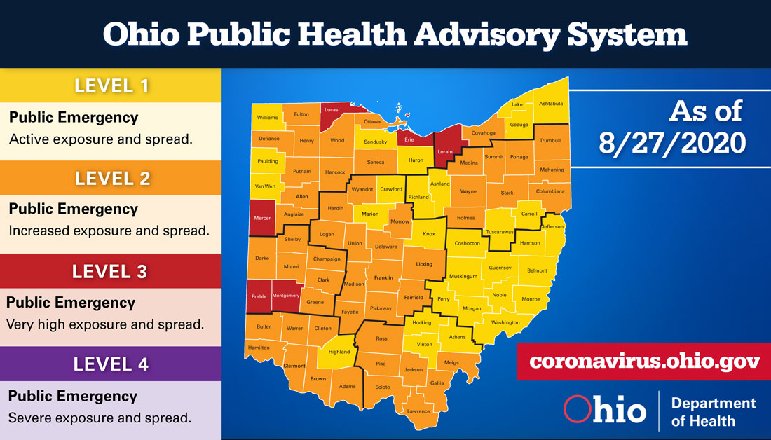
 On August 27, Governor Mike DeWine released the week’s Ohio Public Health Advisory System map. New health data compiled by the Ohio Department of Health indicates that six counties currently have a very high risk of exposure and spread. This is the lowest number of Level 3 counties since the Ohio Public Health Advisory System was developed. In addition, 76 counties have remained at a consistent level, which is the lowest movement between levels that Ohio has experienced.
“While we do have good news in this alert map, this does not give us the green light to change our behavior. It’s only through the interventions that we’ve put in place that we have been able to make these strides,” said Gov. DeWine. “Please continue to wear a mask, stay home when you can, and refrain from gatherings, especially indoors.”
- Montgomery
- Erie
- Lorain
- Lucas
- Mercer
- Preble
- Clark
- Clermont
- Franklin
- Trumbull
- Marion
- Muskingum
- Perry
- Sandusky
Detailed information all of Ohio’s 88 counties can be found on the Ohio Public Health Advisory System’s website. The system was developed to provide local health departments, community leaders, and the public with data and information on the severity of the COVID-19 spread in the counties in which they live. The system consists of four levels with specific risk-level guidelines. Each level is calculated with data gathered on seven public health indicators.