


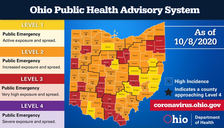
On October 8, Governor Mike DeWine released Ohio’s updated Public Health Advisory System map.
 New health data compiled by the Ohio Department of Health found that 18 counties currently have a very high risk of exposure and spread (Level 3: Ashland, Butler, Fayette, Hamilton, Lawrence, Madison, Mahoning, Marion, Mercer, Montgomery, Muskingum, Pike, Portage, Putnam, Richland, Ross, Scioto, and Trumbull).
“We have 18 Red counties, which is more than we’ve seen since the week of July 23,” said Gov. DeWine. “Additionally, there are 58 Orange counties this week, the highest ever. Ninety-six percent of Ohioans are living in a Red or Orange county. The virus continues to spread quickly throughout the state, and we need to continue staying at home when sick, wearing a mask when out, and keeping at least six feet between you and those outside of your household.”
A county-by-county breakdown outlining the presence of COVID-19 in all of Ohio’s 88 counties can be found on the Ohio Public Health Advisory System’s website.